


Aerial photography has become an essential tool for commercial real estate, providing perspectives that ground-level images can’t.
But accessing high-quality aerial photos without battling Canadian weather, hiring or flying a drone, plane, helicopter, or digging through outdated files can be an expensive headache.
That’s why Smart City Media created a location-based aerial database, making aerial images easily searchable on an interactive map.
- Over 1,000 images available for free (primarily in Vancouver)
- 20,000+ aerial photos in the database across Vancouver, Vancouver Island, Calgary, Edmonton and Toronto.
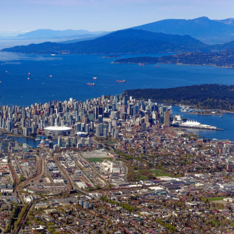
A decade of CRE video production — resulting in a rich resource of aerial photography
For over 10 years, Smart City Media has produced commercial real estate videos across Canada and the U.S., capturing tens of thousands of aerial images along the way. Resulting in a comprehensive database of commercial real estate specific imagery.
Managing a high volume of location specific content made the team at SCM ask:
How can we make it easier for our clients to find and download aerial photos from our database, on-demand?
That question led to the development of a custom aerial database software, making aerial imagery searchable by location on a map. Eliminating the need to spend hours sifting through folders or files when looking for stock photos of various properties or areas of interest.
 20,000+ aerial photos and counting
With Smart City Media’s aerial database, finding stock aerial photos is as easy as plugging in an address to google maps.
- Search for photos by location on an interactive map. Search for photos using an address, or browse the photo map, similar to Google Maps.
- Captured for commercial real estate. Photos of properties, neighbourhoods, landmarks and areas of interest specifically shot for the commercial real estate industry.
- Find & download 1,000+ free images in Metro Vancouver & Toronto. There are thousands of premium (paid) photos also available in Vancouver, Toronto, Edmonton, Calgary, LA, Maui & Phoenix as well.
Thousands of new aerial photos will be added across Canada throughout Spring & Summer 2025.
How are aerial photos used in commercial real estate?
Marketing materials & investment presentations
- Enhance brochures, CIMs, and decks with aerial imagery highlighting accessibility, infrastructure, traffic, and demographics.
- Showcase site potential in context with surrounding properties, demand drivers, and key amenities.
- Support due diligence, environmental assessments, and land-use planning with detailed aerial insights.
Social media & news coverage
- Use aerials in social media, blogs, and news articles to contextualize subject properties or locations.
- Create eye-catching visuals and convert images into animated videos or GIFs for better engagement.
Showcasing large-scale properties & locations
- Capture industrial parks, logistics hubs, multi-acre properties, communities, and growth nodes that drones can’t fully cover in a single shot.
- Provide high-resolution, up-to-date images that offer a clearer, more detailed perspective than outdated satellite views.
Site selection & urban planning
- Monitor neighborhood growth, transit expansion, and commercial development over time.
- Support zoning analysis, feasibility studies, and site planning with accurate aerial overviews.
- Enhance public consultations and development proposals with high-resolution visuals that maintain quality at any scale.
 How can you find and download free photos?
Create a free account and gain instant access to 1,000+ free aerial images (+ over 19,000 premium photos available for purchase in Vancouver, Vancouver Island, Calgary, Edmonton, Toronto, Maui, LA & Phoenix)
With thousands of new images coming soon, this resource is constantly expanding.
Do you need specific photos that you can’t find online?
